OpenGov Voices: Open Government goes on a field trip
Disclaimer: The opinions expressed by the guest blogger and those providing comments are theirs alone and do not reflect the opinions of the  Sunlight Foundation or any employee thereof. Sunlight Foundation is not responsible for the accuracy of any of the information within the guest blog.
Laci Videmsky (“lah-tsi” not “lay-see”) is the Project Director for the New California Water Atlas. He is also Co-founder of Nerds for Nature a group that promotes citizen science and civic engagement. When not building things on the internet, he is likely with his kids looking for magical waves to surf.
After a long day of participating in a Code of Oakland hackathon last year geared toward addressing the multitude of issues facing our city, many of us participants gathered at a local restaurant to debrief, talk shop, and unwind. We are programmers, data nerds, product designers and policy wonks. We are passionate about exploring the potential of information age resources to reshape our communities and the governing bodies that serve them. There have been some exciting success stories with projects that we have prototyped and many more epic failures. We adventure onward.
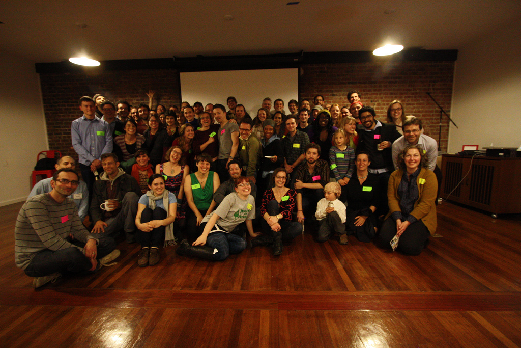
Around the dinner table that night, something different was in the air. The usual discussion about potholes, crime statistics and budget transparency was scant. Instead, we were talking, fisheries, water distribution, air-quality, regional land-use and biodiversity. Here we were, technologists passionately connecting over these topics, yet unable to cite instances of such engagement in the Open Government and civic hacker movement. That night, was the beginning of a group called Nerds for Nature and, since then, we have been exploring the idea of sending nerds not just to City Hall, but to our bureaus of land, water, and energy. These are civic institutions too and they stand to benefit from the creative spirit, ethos, and citizenship that the Open Government movement is known for. As for our shared natural resources and environmental health, many opportunities exist with such an approach.
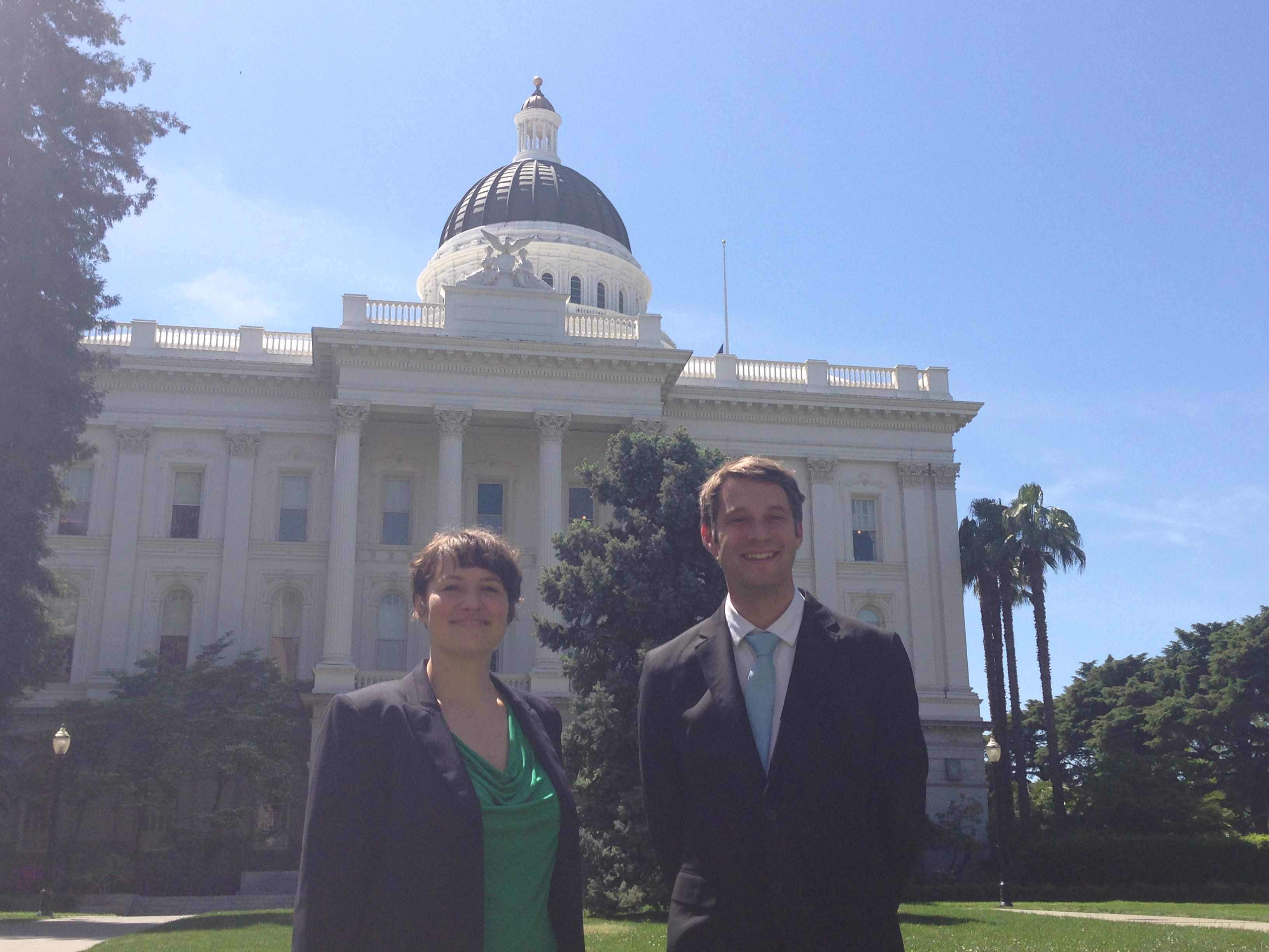
The following story brings together a former Resource Secretary of California, two passionate nerds, California’s water, and a new chapter in the Open Government movement. Along with Co-founder of Nerds for Nature and former Code for America fellow Chacha Sikes, we took a field trip outside our city to explore our large state.
Let the data flow
The story of water resources in California, as well as the agencies that manage them, is unique. It would be an understatement to suggest that the story of water in California is fraught with controversy. Our water wars are legendary. California has the largest engineered system of water delivery and flood control in the world. Water is moved from places of abundance to water scarce regions with the goal of maintaining the largest agricultural economy in North America, as well as supporting urban growth in arid climates. With this large plumbing system, California has managed to green the desert, notably, at the expense of the ecosystems and the communities where the water is sourced.
Water delivery at this Olympic scale has resulted in a myriad of agencies that govern and manage the intricacies of such a resource. Whether managing flows, floods or fisheries, these agencies employ thousands of professionals from all spectra of the environmental sciences. In addition to local and regional bureaus, California has a mix of federal and state agencies that oversee governance and management of water resources and conveyance. These agencies are tasked with collecting data about the resources they manage and making this data available for the public. Data collection practices vary in quality and completeness and public facing repositories of data vary similarly.
The need for good water data mirrors the demand crisis faced by the resource itself. As we quote on our site: “If you can’t measure it, you can’t manage it.” Whether you are a policy analyst, environmental lawyer, agribusiness or an institutional rate payer, information that can help you estimate uncertainty and calculate risk is worth its weight in gold, or water, if you live in California. For citizens concerned with hydraulic fracturing, data about ground water resources and water quality are hard to come by. Not to mention that the water data that is available is fragmented, scattered across multiple sites, and not provided in machine readable formats. Our research revealed a number of water data initiatives that would potentially impact the state of California:
– Water Plan Information Exchange PIE, California Department of Water Resources
– State Water Analysis Network SWAN, California Department of Water Resources
– WaterSMART, US. Department of the Interior/US. Bureau of Reclamation/USGS
– National Water Census, US. Department of the Interior/US. Geographical Survey
Some of these initiatives are a decade in the making, have a multitude of reports and have spawned a plethora of sub-committees in their wake. Apart from the USGS, none of these initiatives have procured a public facing data catalog with machine readable formats or an infrastructure for automated retrieval. Unless you are a programmer and know how to write a scraper or you are crazy and want to click “download” thousands of times, deep into the night, these interfaces are practically unusable.
Naturally, government is slow as compared to the private sector to implement contemporary data best practices.
What we are doing
Inspired by a book, yes, a book, we embarked on an ambitious quest to tell the story of water management, governance and ecological health in our state. The California Water Atlas (1979) is an epic volume that took two years for an impressive roster of professionals to complete. It elegantly presents our complex water system in a manner that is both simple and comprehensive. This Atlas was produced by the Governor’s Office and we are inspired by this early effort, which demonstrates that, despite current trends in public opinion, government is capable of wonderful things. Motivated by its systems level perspective, stunning data visualizations, and commitment to providing the layperson with a basic understanding of how water is distributed geographically and politically, we are enthusiastically building one for the next generation. What would today’s “smart” Atlas look like?
Our New California Water Atlas presents users with an intuitive interface, gathers all the data into a single place, provides a RESTful API, and bulk data downloads. We hope to reclaim the word “Atlas” by asserting its dynamism and offer other innovators a platform from which they can develop their own tools. Open data is crucial to the viability of such a platform. Therefore, our initial task has been to reform state agency data and work alongside them to improve their data practices.
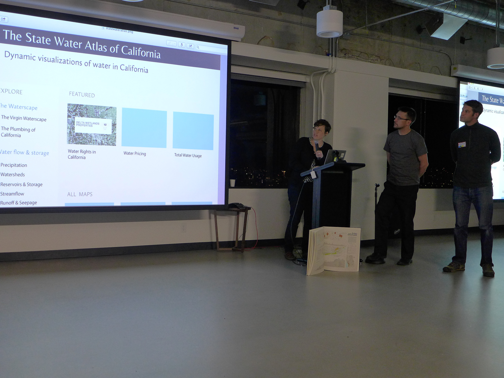
This new California Water Atlas is being designed in a modular way. We launched our first module earlier this month, which visualizes California water rights data. Water rights are a granted permission to move water from a surface or groundwater source intended strictly for “reasonable” and “beneficial” use. A typical farmer who needs to irrigate his/her crops either owns a water right or receives water through a local government agency, who holds a larger right or contract. In California, the overwhelming majority of water is used for agriculture and industry. The continued efforts of urban conservation, while laudable and necessary, are dwarfed relative to the systemic losses and inefficiencies of agriculture and the conveyance infrastructure that delivers water to them.
Therefore, water rights are very important when negotiating scarcity issues. The State Water Resources Control Board (SWRCB), which oversees California’s water rights, needs help and guidance, as expected, with their data and data sharing methods.
As eager data liberators, we went ahead and built a scrapper. It is hard to begin a dialogue with nothing to show, so we proceeded to design something that would demonstrate the quality and functionality that this type of public data deserves. With the help of numerous water experts, the former Resource Secretary Huey Johnson (currently the Founder and President of the Resource Renewal Institute ), and funding from Patagonia, we built a user-friendly, searchable, and share-ready tool for water rights data.
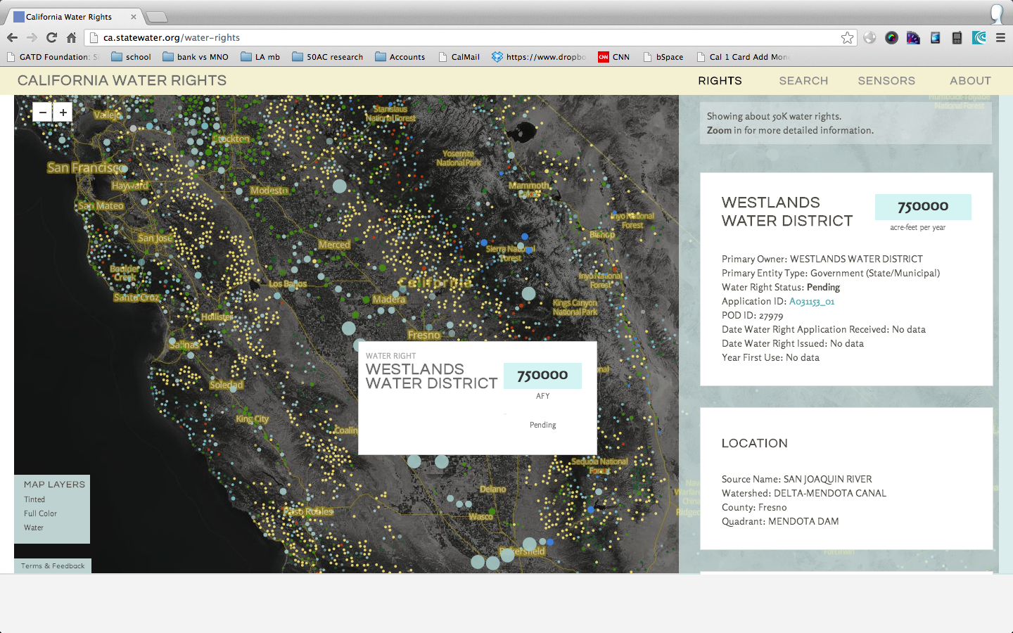
We launched the California Water Rights Atlas during a press conference in our state capitol. SWRCB members who attended our press conference and launch expressed excitement about this new interface, while sharing misgivings about some of our language and fear of un-ending phone calls. These staffers graciously offered to collaborate with us to make these timely changes, despite their critiques. Victory for Open Government! We learned a valuable lesson that day: empathize with the people that work for these agencies and keep them informed about what you are doing throughout. While we did a good job of keeping them current on our activities, empathy requires real experiences and face-to-face contact. We are eager to maintain and expand this rapport, to build something wonderful that honors the people of California and their shared water resources.
The future
We need more nerds for nature. Climate change and increasing scarcity of our natural resources globally demand that we address the problem from a variety of disciplines and sectors. Open Government initiatives have only lightly touched on this scope and genre of governance. There are promising opportunities for our burgeoning field to address how our public institutions are managing our natural resources at the local, state, and federal level. Natural systems operate simultaneously at a variety of scales, requiring flexibility and creativity to navigate the parallel, sometimes overlapping, management regimes across agencies. Throughout history, many have mused over the watershed boundary as the “real” political boundary. In our manifold information driven society, how might we achieve new insight with our tools and culture to aid in a more thoughtful and deliberate distribution of resources and further conflate biophysical boundaries with our perceived anthropocentric ones? Nerds, lets go on a field trip!
Interested in writing a guest blog for Sunlight? Email us at guestblog@sunlightfoundation.com