OpenGov Voices: How 596 Acres is opening up vacant lots data
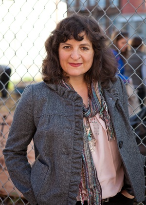
Paula Segal, founding director of 596 Acres. Image credit: Lauren Silberman
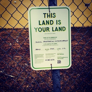
596 Acres has been running a pilot project that helps neighbors see opportunities in the fenced vacant lots of New York City’s most historically disadvantaged neighborhoods since August, 2011. We created a map of city-owned vacant land developed from available Open Data and hands-on manipulation of that data to transform it into useful information. This map is the foundation of the NYC Community Land Access Project and has evolved over the last three years to include social networking features that have already supported 143 neighbor-led campaigns to transform vacant lots throughout New York City into gardens, farms and play spaces. We have built a specialized rolodex that leads New Yorkers directly to the individuals in city government who can answer their questions about the specific lots in their lives, cutting through the confusion of sixteen city agencies that hold land, with different inventory stewards for different boroughs and confusion about who the decision makers really are. The mapping tool also allows us, as the NYC Community Land Access Project, to put signs with specific information about city agency owners, directly on the fences of city-owned vacant lots.
Twenty-two groups have gotten official permission to access the lots in their lives so far, transforming 4.2 acres of fenced vacant parcels of land into open community spaces. Through the tool and direct hands-on advocacy, we are opening up the commons and creating spaces where people have the opportunity to build the city, together.
Our experience with the pilot project has led to three key partnerships with advocates in other cities: we built Grounded In Philly with the Garden Justice Legal Initiative in 2012, Living Lots NOLA with the New Orleans Food and Farm Network in 2013 and will soon be launching LA Open Acres with Community Health Councils in Los Angeles. Each of these tools transforms available data into information that is useful for understanding opportunities for community land access in each city’s particular policy and real estate environment. ¹In each instance, we have re-used portions of the code and re-applied the most effective pieces of the design, iteratively developing a platform for community land access called Living Lots. And in each city, advocates are using the tools to help protect existing community-managed open spaces, connect new farmers with land owners who want to see their urban land put to use, encourage land-holding agencies to make their lots available to the people who live near the lots and of course, help neighbors connect directly with the decision makers who hold the keys to the lots in their lives.
This fall, with the help of a Sunlight Foundation OpenGov Grant, we’ll be bringing Living Lots home and making a huge leap in the evolution of our NYC pilot project by creating Living Lots NYC. Living Lots NYC will be faster, include key filters (e.g. you’ll be able to see the lots in a particular community or city council district), show parcel outlines (which we can do now that MapPLUTO is free), have improved design, updated data about community gardens (thanks to an updated survey by our friends at GrowNYC), information about lots that were planned as “open space” under urban renewal (we have done an extensive analysis of all the plans the city has ever created), contact information for community boards directly associated with each lot and more intuitive social networking and case-tracking features. To get a sense of where it’s going, check out Living Lots NOLA.
In New York City alone, hundreds of city-owned sites languish, located primarily in low-income communities of color, collecting garbage and blighting the very neighborhoods they could enliven. Taken together, these forgotten spaces — fenced-off, inaccessible and lost to bureaucratic neglect — are larger than most city parks. Through this land access counters the inequitable distribution of green space by creating new parks and gardens in under-resourced communities, while grassroots, community-driven process addresses systemic inequities by translating civic data and bureaucratic processes into actionable information for community members.
The uneven growth of healthy places is compounded by an uneven access to information about how people can influence the development of such places where they live. A lack of developed and maintained green spaces is just one symptom of municipal neglect; a lack of information about how people can shape the city comes with it. Living Lots is changing all that and we’re thrilled to bring it home.
It’s not about technology, that’s too easy. It’s not about community gardens, that’s too messy. It’s about the right to remake ourselves by remaking the city.
Paula Z. Segal is the founding director of 596 Acres, a Sunlight Foundation OpenGov Grantee and a graduate of City University of New York Law School at Queens College and she has worked in the Economic Justice Project at Main Street Legal Services. Before joining the legal profession, Paula ran an all-volunteer adult English school on the Lower East Side and was a member of the Empty Vessel Project. She is an attorney admitted to practice in New York State and a partner in her own firm, Mohen & Segal, which focuses on legal services for entities working on our shared sustainable economy. You can reach her at paula@596acres.org
Interested in writing a guest blog for Sunlight? Email us at guestblog@sunlightfoundation.com